Halley's Quest: A Selfless Genius and His Troubled Paramore (2005)
Chapter: Second Voyage 1699-1700: 6 Outward Bound
CHAPTER 6
OUTWARD BOUND
It was between three and four in the afternoon, according to the cant of the October sun. At sea for a month, the Paramore was approaching the Canary Islands. Although Halley’s call for a new ship had been immediately denied back in July, his request for new officers was fulfilled. Only seven of the original crew returned. The monarchy had granted him 24 men—four extra because his botswain had only one arm. Halley received his new charge as master and commander in late August 1699 and his sailing orders in mid-September. This time out he would leave little to chance: After the experience with his insubordinate lieutenant, he would forego a second in command.
Halley was determined not to let the Paramore’s unresolved defects interfere with accomplishing his mission. He wholly believed that on his return his mission would “answer the expectations of those who perhaps censure the performance of my last voyage, without examining all the circumstances.”
When he set sail in late September from the Downs with “a very
fine sky and a curious gale,” it was well into hurricane season, but he brimmed with confidence, the court-martial behind him. The Falconbird, a Royal African Company ship, had escorted him past the most treacherous sections of the African coast. On reaching Madeira, the crew preferred to stay at sea to going to port. “People chose rather to go without their wine than to lie beating in so much danger of the Sally rovers,” Halley wrote.
But fate tilted the odds once again. The next day, a vengeful squall arose from nowhere, as if to play with the ship before it reached a friendlier harbor. Suddenly, a large wave smacked the side of the Paramore. Halley’s cabin boy fell overboard. “We brought the ship immediately a stays and heaved out an oar,” Halley recorded in his journal. Manly White was barely a teenager and a favorite of Halley’s. The crew kept searching for two hours, “but the sea being high and the ship having fresh way, we lost sight of him and could not succor him.” A solemn Halley acknowledged the failure of his rescue attempt in his journal. “At 6, I bore away south west, not thinking it advisable to stay turning to windward in the latt of Madeira.”
The loss of a man overboard was usually a devastating event for all shipmates. As a later seaman once described: “There is a suddenness in the event, and a difficulty in realizing it, which give to it an air of awful mystery…. The man is near you—at your side—you hear his voice, and in an instant he is gone, and nothing but a vacancy shows his loss. Then, too, at sea—to use a homely but expressive phrase—you miss a man so much…. There is always an empty berth in the forecastle, and one man wanting when the small night watch is mustered. There is one less to take the wheel, and one less to lay out with you upon the yard.”
And Halley was probably more sensitive than the average sailor. The drowning of his devoted cabin boy would scar Halley’s psyche for life. Though toughened by his time at sea, Halley “was so deeply affected with the loss that during his whole life afterwards he never mentioned it without tears,” according to accounts from friends and 20th-century biographer Eugene MacPike. The tragedy was more
than Halley had bargained for when he undertook the second voyage. If the dreadful mid-October event distracted him from his scientific quest, necessity demanded he and the crew overcome it.
IN HALLEY’S DAY, DIVINATIONS OF THE heavens guided voyagers on Earth. Astronomy and navigation were inseparable. Sailing much beyond sight of landmarks required knowledge of the sky and the magnetic compass. To figure out where one was at sea (in terms of latitude), navigators would approximate a position by calculating the angle between the radius of the location and axes fixed in the Earth.
Location was also inexorably tied to time. The relative positions of the Sun, stars, and planets comprise the intricate inner workings of a celestial timepiece. But to tell accurate time using the mechanics of heavenly bodies at sea required clear visibility, a level deck, smooth seas, and at least several hours to calculate it. Plus, astronomy’s clock was only partially understood theoretically speaking. And it worked only at certain times, depending on whether the navigator had the appropriate data at hand to make sense of it. For example, to use the Sun’s altitude in a calculation, a mariner had to know how the polar distance to the Sun varied with the seasons. From the perspective of Earth, the Sun’s path tilts in relation to the equator.
Halley was far better at making such calculations than most sea captains, who often relied on knowledge from previous trips, mere guesswork, and muddled musings. Even among scientists, Halley stood out as a meticulous observer. His credentials as an astronomer and his patient respect for scientific method placed him among the best navigators in the world.
Latitude, for the most part, was relatively easy to determine. And because many voyages traversed virtually due east to west or west to east, a captain merely had to find the right latitude and stay the course. Navigators of the time were versed in the procedure: Latitude was simply 90 degrees minus the angular distance to the North Pole. They also knew how to pinpoint latitude and local time from the altitude of the Sun, provided the distance to the North Pole was known.
Longitude, by contrast, befuddled mariners at the time of Halley’s adventures at sea. But certain techniques worked under favorable conditions. Whenever possible along his sailing route, Halley calculated longitude at sea by employing several methods (all made easier when in sight of land). Most often he used dead reckoning with plots of latitude. He also relied on two astronomical clocks: determinations of lunar distances and timings of the eclipses of the satellites of Jupiter.
From the Moon’s position in the sky, Halley obtained some guidance, although the Moon’s irregular motion, which then was poorly understood, limited the accuracy of such determinations of longitude. But to succeed in his mission to chart the natural fluctuations in the Earth’s magnetic field, accuracy was critical.
In his writings, Halley revealed how he made such observations. “From whence, at all times, under the like situation of the Sun and Moon, I might … have the effect of exact lunar tables capable to serve at sea, for finding the Longitude with the desired certainty.” When other methods failed him, he used this method, as he describes: “Having by my own experience found the impracticability of all other methods proposed for that purpose, but that derived from a perfect knowledge of the Moon’s motion.”
Observing the eclipses and relative positions of the moons of Jupiter and the planet itself was often more helpful—at least when measured on the steadiness of landfall. Galileo had recognized this several decades earlier. On Halley’s journeys, however, he used Jupiter’s moons as clocks only when at port, not at sea, because of the difficulties viewing them from a tossing and pitching ship. But he told how he made such observations aboard ship when necessary:
I had found it only needed a little practice to be able to manage a five or six foot telescope, capable of showing the appulses [near approach] or occultations [hiding of a bright object by passage of a body in front of it] of the fixed stars by the moon, on shipboard, in moderate weather; … whereas the eclipses of the satellites of Jupiter, how proper so ever for
geographical purposes, were absolutely unfit at sea, as requiring telescopes of a greater length than can well be directed in the rolling motion of a ship in the ocean…. So in the remote voyages I have since taken to ascertain the magnetic variations they have been of signal use to me, in determining the longitude of my ship, as often as I could get sight of a near transit of the Moon by a known fixed star: And thereby I have frequently corrected my journal from those errors which are unavoidable in long sea reckonings.
Although Halley managed to observe from the deck of a moving ship in mild conditions with a short telescope, using the longer scope often met with trouble. On his first voyage in March 1699, when attempting to observe a satellite of Jupiter from the coast of Brazil, for example, he failed to catch sight of its eclipse because the “great height of the planet, and want of a convenient support of my long telescope, made it impracticable.”
And then a month later, in Barbados, he encountered more difficulty. He was observing an immersion of Jupiter’s first satellite when, “the wind shaking my tube, I was willing to get a more covered place to observe in, that I might be more certain, but when I again got sight of the planet, the Satellite appeared no more.”
Still his longitude calculations at various ports throughout much of his journey were the most accurate to date. In fact, some of his calculations, such as those at Bona Vista and St. Iago at 23 degrees, 0 minutes west longitude, and 22 degrees, 40 minutes west longitude, respectively, reflect the modern true values. However, once he crossed the equator at the African coast, his measurements were off by about half a degree per day because he failed to factor in westerly equatorial currents, which were imperceptible to him.
IT WAS THE VOLUBLE SEA—indifferent and, as Halley experienced from the loss of his cabin boy, unforgiving—that shaped much of Halley’s scientific agenda. At the top of his wish list, Halley wanted a fast local fix for navigation, available day or night no matter what the cloud cover. Probably the biggest grail was longitude. By turning his atten-
tion from the heavens to Earth’s mysterious magnetism, Halley had hoped for big things. No one had known what exactly to expect.
Halley had eyed the quivering needle within his 52-foot Paramore and recorded, as best he could, the reading from magnetic north. It was off kilter from true north. How much off kilter depended, of course, on the ship’s location. On his first voyage, Halley made his first observation in Portland Road on the way out of the English Channel, recording the magnetic variation with great diligence. He made a single measure of the magnetic amplitude at sunset. He allowed for refraction on the horizon and then compared the result with the Sun’s computed azimuth from geographical north.
What pattern might emerge from all these scattered readings at points in the North and South Atlantic? His first mission, though yielding promising results, had left the question open-ended. This time out his directive built on the scientific objectives of his first journey. Halley believed it might be possible to calculate longitude from the observed distance between magnetic north and true north. In this way, the magnetic variation could be used to identify those vexing but important lines oriented in a north-south fashion, whose spacing widened with the bulge of the earth.
What’s more, this Royal Society fellow believed such a method could be universally true—good at all locations on the globe. It clearly worked for certain spots. And, best of all, the method would not require knowing the accurate time locally (an important point since even the best human-made clockworks kept poor time) or at the pole or reference point.
NAVIGATION WAS NO small matter. About the time of Halley’s birth, England began operating under the economic idea of mercantilism. The principle held that for a maritime nation to increase its wealth the value of the country’s imports could not exceed its exports. Colonization of overseas lands became the easiest way to offset negative trade balances with other countries. In 1650, 1651, and 1660, the English Parliament enacted the Navigation Acts, which by restricting
England’s colonial trade exclusively to English and Irish ships helped establish the nation as a commercial power in Europe. The trade winds carried a plethora of tobacco, sugar, and other stores from her colonies in the Americas and West Indies. The supply of such commodities was steady enough to meet the needs not only of the upper classes but of the hoi polloi. Necessity had supplanted luxury. To finance the import of goods, countries began manufacturing goods for export. The flurry of trade would lay the foundation for the Industrial Revolution.
Of course, the Navigation Acts also served to fill the ranks of the Royal Navy at wartime and to protect trade routes. About the time of Halley’s sea adventures, England’s sea enterprise controlled some 4,300 ships weighing in at 340,000 tons and employed 55,000 seamen and at least another 50,000 hands to build and maintain the vessels. Though diminutive in comparison to today’s tankers, most ships averaged 400 tons and were big in comparison to Halley’s 80-ton pink. They typically averaged one round-trip voyage to the West Indies or North America each year. Only a dozen or so even larger ships would venture to the East Indies and China—generally a two-year endeavor.
The slave trade, in particular, raised the stakes for solving the longitude problem in the late 17th century. To maximize profits from the round-trip voyage from England to Africa to the West Indies and back to England, merchants exchanged slaves for sugar and other commodities. Such routes could not be easily achieved by merely sticking to a line of latitude.
Halley, arguably a seaman in his own right, had long been interested in advancing England’s nautical prowess. In a letter written in 1695 to Samuel Pepys then retired as Secretary of the Admiralty, the administrative head of the Royal Navy, he criticized the “imperfect measure of knowledge in our ordinary navigation.” For example, he noted that on a cloudy day sea captains could rely only on soundings to determine their position. In his letter Halley recognized the talents of such peers as Sir Anthony Dean, whom he considered “the great master of naval skill. No man can more scientifically give or account
thereof than he.” But Halley believed that navigation on the whole was still more guesswork than science. He disparaged “the absurd way of keeping their reckonings by the Plain Chart,” as opposed to using the Mercator, which supposes the meridian is parallel and had been available for use on ocean passages for some 60 years. “In time of war, this erroneous manner of keeping the keel of the ships way by the Plain Chart occasions the loss of many ships,” he continued.
International politics conspired to make his mission even more alluring. The Navigation Acts that enabled England to prosper also set off 60 years of feuding with Holland over supremacy of the sea. The first war erupted in 1652, roughly five years before Halley’s birth. France, under Louis XIV, also entered the contest to control the world’s oceans. The French first allied themselves with the Dutch to wage war against England in 1666. But the coalition fell apart two years later when Louis XIV tried to claim control of the Spanish monarchy by right of his marriage to a Spanish wife. His mounting aggression troubled the Dutch. In 1672, France and England joined forces to invade Holland.
Within two years England would withdraw from the conflict. The 1688 revolution of English Protestants against the Catholic King James II would lead to England and Holland forming an alliance. The bond was strong enough to squash France’s bid to control ocean commerce. In this manner, the sea, or at minimum the human drive to dominant the oceans, would help change the course of English science.
ONCE AGAIN PAST MADEIRA, the Paramore and its crew pushed on. Eight days after the October accidental drowning, they made the island of Sal, one of the northern Cape Verde islands. Once ashore, Halley encountered a “Portuguese there with some few Black servants, who assured us there was no salt to be had, the salt pens being all in the water, we had leave to hunt and our people killed and brought aboard two Cabritos [an antelope variety], one very fat with good meat. We saw a turtle in the road, and turtle tracks on shore so four of our
hands stayed on shore this night, and the next morning they brought off two turtles…. The Portuguese promised me some salt but made me stay till evening for it, and it was not much above a bushel when it came, bad salt mixed with dirt.”
They sailed on from the island of Sal following the same course as the first voyage but absent the draining tension. They passed Bona Vista and then anchored at St. Iago. At both sites Halley successfully measured the longitude. From St. Iago, Halley reported back to London that all was well with the mission and that he was satisfied with his new officers. However, the native Portuguese were not all that hospitable. Halley bought the favor of a lieutenant and his sergeants for the “value of 5 dollars” and “none of my folks had anything taken from them,” Halley noted in his journal. But ashore there was no market to be found. And those very same officers “would not let the botswain dispose of cheese or let us go to the country to buy fowls. This treatment I was obliged to put up with, on the accord of my small force, perhaps more men and guns might have procured better usage of them.”
In early November “a smart tornado put us under our course,” Halley recorded, and it was not long before the constellations changed to include the brilliant Southern Cross. On December 4, Halley managed to take a longitude reading because of a celestial event: the Moon passing in front of a fixed star in the Virgo constellation. “The moon did exactly touch this star with her southern limb at 3:15 in the morning at 3:20:20. The southern horn was just 2 minutes past the star. Having carefully examined this observation and compared with former observations made in England, I conclude I am in True Longitude from London at the time of the observations at 30:15.”
Then on December 9 they “all smelled a very fragrant smell of flowers which the wind brought of the land; and several butterflies flew on board.” They reached Rio de Janeiro on December 14 and entered the mountainous harbor then under the governorship of Artur de Sa e Meneses. The Paramore stayed in this enchanting port for two weeks as Halley again enjoyed Portuguese hospitality and the
pleasant summer of the Southern Hemisphere. On the 29th the Paramore managed to leave the charms of Rio for the most dangerous part of the voyage: the search for terra incognita.
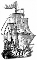
THE PARAMORE’S GEAR included a large brass sextant, quadrant, log and sounding lines, a pendulum clock (to tell time at night) that audibly tick-tocked, and two azimuth compasses. Above all, the magnetic steadiness of the compass was key in calculating longitude and determining if a search was being efficiently conducted. It was central to Halley’s toolbox and hypothesis. And because a compass or two were standard equipment on all seagoing ships—no mariner would be without one—Halley knew his work could have immediate impact.
Familiar with Elizabethan physician William Gilbert’s writings circa 1600 entitled De Magnete and the leading discussions since, Halley sought to better understand the invisible forces that made the needle swing. A contemporary of Shakespeare, Gilbert was the first to appreciate the reason a magnetic needle aligns itself roughly north or south along the meridians: terrestrial magnetism. He saw Earth itself as a gargantuan magnet.
Following on Gilbert and others, Halley elaborated on magnetism in a series of papers published in preparation for his journey aboard the Paramore. In a 1692 paper he hypothesized that Earth has four poles: two in its outer shell and two in its nucleus. In between a fluid medium might separate the inner and outer globes. He suggested that the outer shell rotated slightly faster than the inner one, accounting for the gradual shifting of Earth’s magnetic field.
By the time of his second voyage, Halley had on board a barometer and a thermometer (the Fahrenheit scale was still about 20 years off). Finding the cause of atmospheric pressure changes was among Halley’s many laboratory pursuits before his voyages. In his day the cause of the phenomenon remained a mystery. According to his logs, he recorded temperature and pressure daily with the latest devices. He carried one of Hooke’s ingenious inventions: a marine barometer, specifically designed for use at sea. With it Hooke, indeed a bit
overoptimistically, believed that “the observations of the weather may perhaps in great measure be timely enough discovered by the inquisitive and diligent mariner.” Halley, however, backed Hooke’s claims. He would later tell the Royal Society: “It never failed to prognostic [sic] and give early notice of all the bad weather we had.”
In essence, the Paramore was the world’s first floating observatory. Its cache of scientific instruments and books was superlative. Halley ported that long 20-foot refracting telescope and possibly even his 24-footer aboard the Paramore, scholars believe, even though such scopes were somewhat ungainly on land, let alone in a tossing, salt-sprayed ship. But to Halley it was essential for viewing the moons of Earth and Jupiter. (Science historians, however, believe a 15- to 18-foot scope could have successfully captured the satellites. This minimum length was necessary to minimize spherical and chromatic irregularities.) According to his accounts to the Royal Society, Halley modified his telescope with a reflecting plate, an innovation first conceived by Newton to counter distortions inherent in such refracting scopes.
His portable arsenal of devices couldn’t compete with the accuracy of the reigning permanent observatories of the day, especially those in Greenwich or Cassini’s Paris. Many of Flamsteed’s observations, for example, were remarkably precise even by today’s standards.
Halley also took with him a library of sea tables and star catalogs. The books included records of the Sun’s declination used to calculate latitude and tables of the Moon’s position and Jupiter’s position for finding longitude.
Luckily for Halley, London was England’s center of navigational know-how. It housed most of the country’s printers, publishers, authors, and cartographers as well as most if its makers of fine navigational and scientific instruments. Instructors versed in the art of navigation taught their science-based craft in the city on the Thames. Halley had grown up with access to the best nautical tools. About one-third of England’s merchant ships—yet half the nation’s tonnage—ran out of London.
For the most part, commercial sea companies were enlightened: Using the latest in navigation techniques was the best and least expensive insurance. And Halley desired similar coverage for his missions.
The books he brought with him probably included the newest edition of The English Pilot, issued in 1690. The ambitious book was the work of London’s famed instrument maker and chart publisher, John Seller. First published in 1669, it included a sea atlas that detailed the world’s seas and assorted volumes on specific seas. It was modestly subtitled Sea Waggoner for the Whole World, with Charts and Draughts of Particular Places, and a Large Description of All the Roads, Harbors, and Havens, with the Dangers, Depths and Soundings in Most Parts of the World. By all accounts, it was a vast improvement over the waggoners in circulation. These combined nautical manuals and chart books, first introduced by their namesake Dutch seaman Lucas Waghenaer in 1585, became almost obligatory at sea for all captains. The southern version included maps and directions for the Atlantic islands that Halley was passing in this leg of the mission: the Madeiras, the Canary Islands, Cape Verdes, and the Azores.
By the time Halley sailed, one of Seller’s rivals, William Fisher, had come out with an English Pilot of his own that covered America and the West Indies. It was updated in 1698 and would have been an essential tool for Halley. By the time of Halley’s voyages, the list of available titles was long. In 1685 Captain Daniel Newhouse published The Whole Art of Navigation, with a newer version in 1698; in 1686 James Atkinson published The Seaman’s New Epitome; and in 1695 the mathematician Samuel Newton (no relation to Isaac) came out with An Idea of Geography and Navigation. Halley also likely carried a copy of the latest Atlas Maritimus, which depicted the South Atlantic, and a copy of William Dampier’s A New Voyage Round the World; Describing Particularly the … Islands in the West Indies, the Isles of Cape Verde, the Passage by Terra del Fuego … and Santa Helena, which had just been published in February 1697, and many others.
Lieutenant Harrison’s Idea Longitudinis; Being, a Brief Definition of the Best Known Axioms for Finding the Longitude had been available at booksellers since 1696. It’s probably safe to assume there was not a copy of that on Halley’s second voyage.
Of London’s five chart specialty shops, Seller’s was the most interesting and well known. The pioneering entrepreneur made and sold naval instruments and taught how to use them. He procured sandglasses (hourglasses) and sea compasses for the Navy Board. And along with fellow chart maker Joseph Moxon, he served as hydrographer to the king. Nearly a dozen other London shops also sold nautical maps.
IN LATE JANUARY 1700, THE THERMOMETER on the Paramore plummeted toward the freezing point. The shallow-bottomed vessel lurched southward to the edge of existing charts. Even the least-schooled sailor aboard had sensed danger was mounting as the thermometer continued to drop. Yet none could have suspected the true nature of the terror that lay ahead. Nearby, the ominous black fins of a pod of passing killer whales or perhaps bottle-nosed whales—both mammals until now the stuff of mere legend or perhaps an occasional incredulous sea monster tale—made fitting harbingers of the unknown threat.
As they hedged southward the weather became worse and worse. On January 18, Halley wrote in his journal: “… after midnight it blew extremely hard at N.W. with much lightning, and again a little before sunrise with very terrible lightning which seemed to be just on board us but God be thanked we received no damage by it.” A cold current had replaced the balmy one that had pushed them down the South American coast. The weather continued to grow progressively more violent. And the temperature continued to drop. In the seclusion of Halley’s cabin, “… which had been kept from the air, the thermometer stood but 11 above freezing.”
The water appeared white, and small drifts of seaweed approached the ship. Assorted sea birds flew about. Halley and the crew reckoned that land was near. Then on January 27 a thick fog engulfed the Paramore and would hover for several days. They were likely south of the Falkland Islands. When the great fog dissipated, they saw “several fowls which I take to be penguins … being of two sorts; the one black head and back, with white neck and breast; the other larger and of the color and size of a young Cygnett, having a bill very remarkable hooking downwards, and crying like a bittern.” Soon enough other creatures surfaced: “We have had several of the diving birds with necks like swans pass by us, and this morning a couple of animals which some supposed to be seals but are not so; they bent their tails into a sort of bow … and being disturbed showed very large fins as big as those of a large shark the head not much unlike a turtle.” The fog was almost gone now. The cornucopia of flora and fauna befuddled even his most experienced officers. Halley pondered turning northward, but his course was set.